Chennai Bangalore Link . . .
Few months back, this article was submitted for publication in Madras Musings though it is not published yet. On a recent trip to Avani with college buddies, our conversation leaned towards the road connectivity between the two metros. In this context, am reproducing that article in it's entirety. Hopefully, it turns out to be interesting read !!!
With multiple trains plying between Chennai and Bangalore, offering both day and night services, the route has hit a saturation point in terms of travel options because of the exploding population. Presently road services provide the alternate option. State carriers of the Governments of TamilNadu [T(amil)N(adu) S(tate) T(ransport) C(orporation)] and Karnataka [K(arnataka) S(tate) R(oad) T(ransport) C(orporation)], and private-bus operators provide buses from the basic to luxurious amenities, thus catering to different levels of affordability.
With multiple trains plying between Chennai and Bangalore, offering both day and night services, the route has hit a saturation point in terms of travel options because of the exploding population. Presently road services provide the alternate option. State carriers of the Governments of TamilNadu [T(amil)N(adu) S(tate) T(ransport) C(orporation)] and Karnataka [K(arnataka) S(tate) R(oad) T(ransport) C(orporation)], and private-bus operators provide buses from the basic to luxurious amenities, thus catering to different levels of affordability.
Tracing the origins:
With so many choices in different
modes of transport presently available, it is interesting to trace the origins
of road link between Madras and Bangalore. In the FIRST APPENDIX TO THE
THIRD REPORT OF THE SELECT COMMITTEE OF THE HOUSE OF COMMONS, in the
section titled, PUBLIC WORKS carried
out at Madras, in 1828, mention of ‘Formation
of a road from Madras to Bangalore’ occurs. This report says: “ … the work has been completed to Poonamallee, but beyond that place the work
has been restricted to the object of making it possible for carts and ordinance
carriages”.
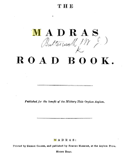
The Madras Road Book (1839)
compiled by Captain William John Butterworth, Assistant Quarter-Master General
of the Army ( printed by George Calder at the Asyum Press, Madras and, published by Edmund Marsden) lists seven routes to travel from Madras to
Bangalore by road. This lists comprehensively the ‘TABLES OF THE ROADS THROUGHOUT THE PRESIDENCY OF FORT ST.GEORGE’,
first written in 1833, revised and enlarged in 1836‒1839.
The
Madras Road Book, 1839
The famous Bradshaw’s Illustrated
Hand-Book to the Madras Presidency and the Central Provinces of India,
published in 1864, provides a complete thorough route and descriptive guide by
road, river and railway, throughout the presidency of Madras. Initiated by George Bradshaw (1801-1853), an
English cartographer, in 1839, Bradshaw’s series served as road and railway
guides for Great Britain and Ireland, France, Germany and Austria, India,
Italy, Syria, Turkey. This series was published by W. J. Adams of London ; the
titles continued until 1961.
This guide is not limited just to
the routes but provides details on social and political status on the various
stations located on the various routes. Covering a distance of 207 miles and a
quarter furlong, the first route shown is between Madras to Bangalore via
Arcot, Waniembaddy (Vaniambadi), Nullapaddy (Nallapadi), Coorumberupatty Pass,
and Ossoor (Hosur). This is followed by four different route options with most
of them passing through either Arkat (Arcot), Chittur (Chittoor), Colar
(Kolar), Ooscotah (Hoskote) or Poonamallee, Chittoor, and Colar.
BRADSHAW's Illustrated Handbook of the Madras Presidency
Having travelled often between these two cities, using buses and trains, I can ascertain that the modern day bus journey follows almost the same route — but the choice reduced to two of them: one via Poonmallee, Vellore, Vaniambadi, Hosur, and the other via Poonamallee, Chittoor, Kolar, Hoskote . A small town, Hosakote is located at the intersection of NH-4 ad NH-207; part of the stretch from Hoskote towards Bangalore is called as Old Madras Road.


Comments